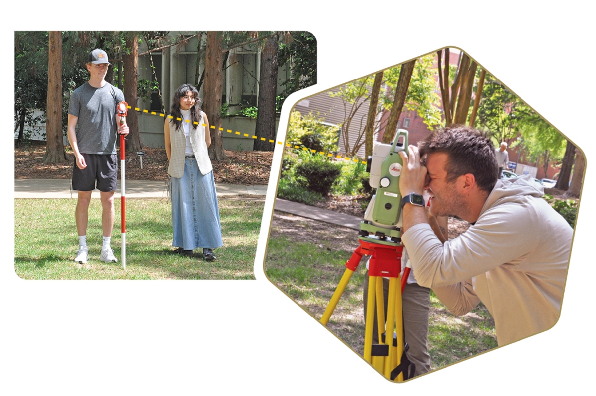
Geomatics students Cullen Ross and Ahtziri Rosales Ramirez using some of CEE's new Leica surveying equipment on the left while Elijah Little sights the Leica Total Station to capture surveying data. (Photo by Michael Hunter)
Surveying was one of the first civil engineering courses taught at Georgia Tech over a century ago. Today’s students are still learning surveying, but with a modern upgrade, thanks to the recent addition of top-of-the-line equipment.
Surveying is the practice of measuring precise location points and mapping features on a piece of land ahead of a construction project or any major design project—one of civil engineering’s foundational skills.
Dwight H. Evans Professor Susan Burns said the new surveying equipment reflects just how much surveying has changed over the years.
“What our students are learning to use today is the same state-of-the-art equipment that allows engineers to combine terrain, spatial features, and a wide range of cultural features into powerful mapping technology,” Burns said. “As our infrastructure systems become more complex, larger scale, the ability to monitor and map using these geospatial technologies becomes even more important.”

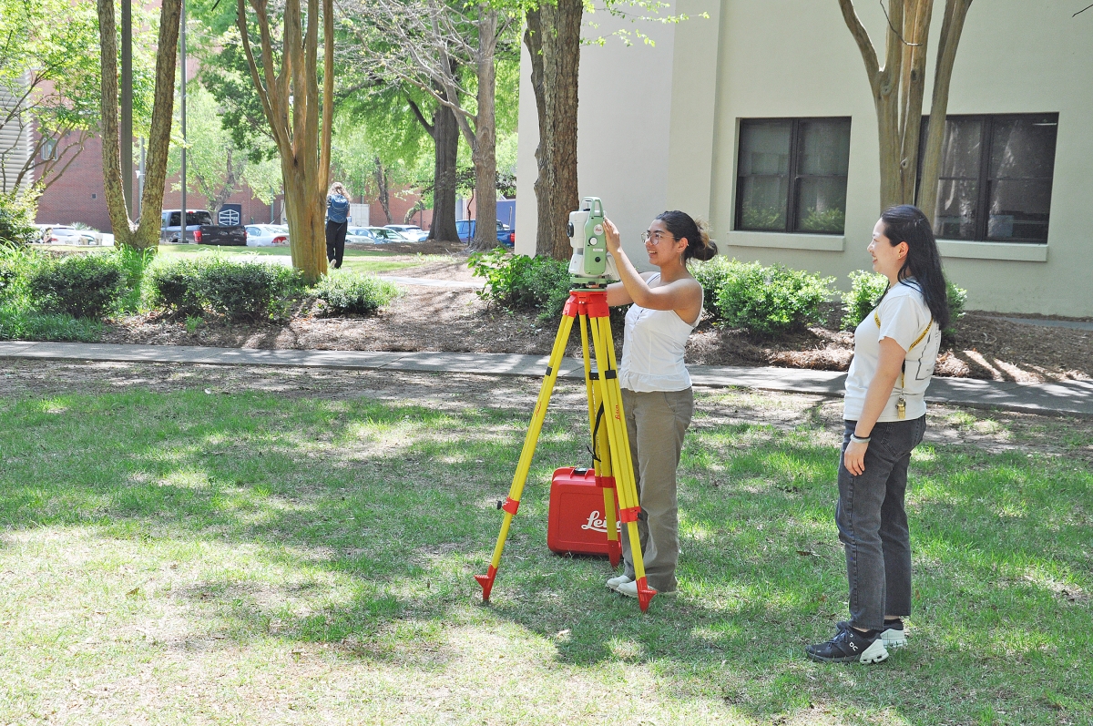
Graduate teaching assistant Kelly Yamamoto observes as geomatics student Maxine McCalla sets up the Leica Total Station. (Photos by Michael Hunter)
Bill Daniel is the COO of Lowe Engineers and a long-time adjunct professor of Geomatics, an elective course that combines surveying and Geographic Information Systems (GIS).
Daniel is a strong proponent of surveying who has taught hundreds of Tech students during his tenure. He is excited about the new surveying equipment and believes it’s a real boon for Georgia Tech.
“It’s a feather in our caps. It’s the most advanced surveying equipment in the world,” Daniel said.
The acquisition of three Leica Total Stations and a drone with LIDAR technology for students to use for their surveying assignments replaced equipment that had been in use for 30 years. Two employees from the manufacturer came to train graduate teaching assistants in the usage of the new equipment. The stations also collect GPS data, which used to require separate equipment.
“It is truly a total station,” Daniel said. “It measures distances, it turns angles, it collects GPS data.”
Daniel began teaching surveying at Georgia Tech in the 90s when the course was a civil engineering requirement known as “Plane Surveying.” When he arrived, he had over 100 students in the class for five straight quarters.
“I’ve been teaching the class for so long, it has definitely morphed and changed over the years,” Daniel said.
Burns, who is also a Georgia Tech alumna, said there has been an enormous change in surveying technology over the last few decades.
“When I graduated from undergrad in 1990, we still taught surveying using a transit and level, which was very old school technology, and we surveyed benchmarks located between the Student Center and Mason Building. Every student surveyed the same loop every quarter,” Burns said. “The technology has revolutionized since then.”
In 2002, the class was renamed Geomatics, adding the GIS component. Currently, Daniel teaches surveying for the first 10 weeks of the semester. For the last five weeks, his Lowe Engineers partner John Drysdale teaches the students how to plug the data harvested from surveying into GIS, which allows the data to be displayed digitally in 3-D or on a map for analysis.
Presently, surveying is no longer a required course for civil and environmental engineers.
Many engineering schools have eliminated surveying classes, which Daniel declares to be “a total crime, in my opinion.”
Daniel believes geomatics is “a fundamental baseline of knowledge for civil and environmental engineers, and something that they use and apply in their careers.”
“Geomatics is important for the civil and environmental engineering student because it is one of the skills that almost all civil and environmental engineers will use and be exposed to in the course of their professional careers,” Daniel explained.
Geomatics is now offered as a technical elective.
“We thought it was a bad thing,” Daniel said of the class being classified an elective. “It has turned out not to be.”
Daniel credits CEE’s student advisors with steering students toward a class with practical applications. “Every semester I get comments about how refreshing it is to have a hands-on lab,” Daniel said.
Kelly Yamamoto, a graduate teaching assistant in the geomatics course, said students have really enjoyed going out into the field and using the new equipment.
“Students think some of the initial equipment they are introduced to is old-fashioned, but then we quickly move to using the top-of-the-line total stations, as well as participating in a drone demo,” said Yamamoto. “Students’ favorite part of this class is the lab portion which provides a hands-on experience of what surveyors actually do.”
Ahtziri Rosales Ramirez, a spring 2025 geomatics student agreed. “It was exciting to go out in the field and work with tools like the total station, as it brought the concepts to life and helped me better understand how data collection and positioning work in real-world scenarios,” she said.
Rosales Ramirez said she is putting what she learned in the class to good use in a GIS-focused internship this summer.

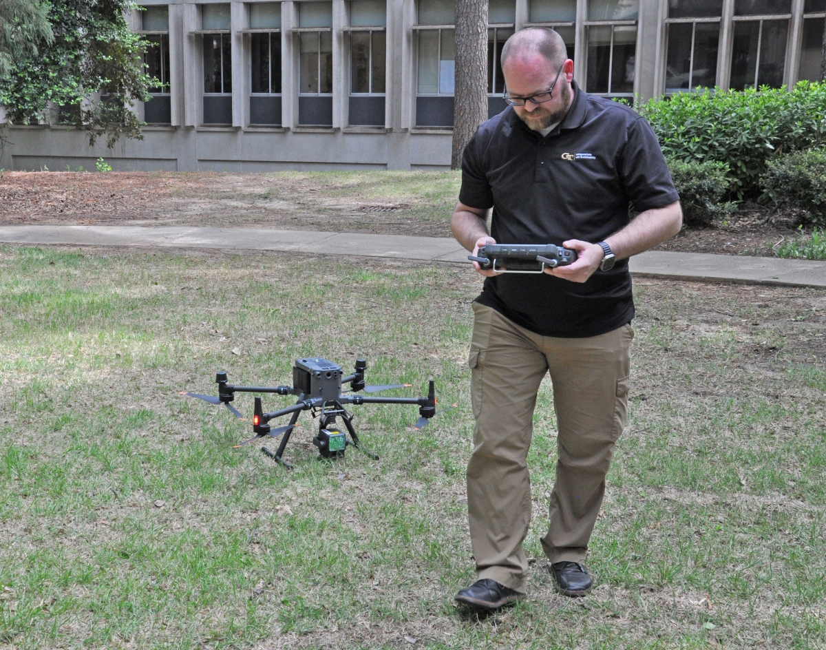
The DJI Matrice M350 RTK drone is operated by Doug Sims, a Senior Systems Support Engineer with Infrastructure and Sustainability at Georgia Tech. (Photo by Michael Hunter)
The drone, a DJI Matrice M350 RTK, is operated by Doug Sims, a Senior Systems Support Engineer with Infrastructure and Sustainability at Georgia Tech. According to Sims, the drone excels in scanning and recording data for a large area at once, in contrast to traditional surveying, which relies on field workers to manually walk an area to capture topographic information as single elevation points. The drone records the elevation of the ground much more accurately and completely than traditional surveying, although processing the large amount of data takes more time afterwards.
The geomatics course continues to be popular, attracting 40 to 50 students every time it is taught.
“I teach the geomatics course with the baseline that the students are unlikely to end up being professional land surveyors, so my mission is to expose them to as many and as much of the different aspects of surveying as possible,” Daniel said. “Now, having the latest new and state-of-the-art equipment, we can truly let our future engineers see what and how we collect data in the field.”
